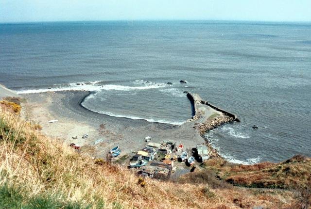
Port Mulgrave
Latitude: 54° 31'N
Longitude: 00° 42'W
Country: England
About Port Mulgrave
The tiny hamlet of Port Mulgrave, created in the 1850s, overlooks the scars (rock outcrops) of the shore. Port Mulgrave owes its existence to the ironstone industry. It was a thriving community in the late 1800s when locally mined ironstone was shipped from the specially-constructed harbour.The blocked-up mine entrance can still be seen 50 feet above high water above what remains of the harbour. Tunnelling began in 1854 and work on the harbour had started two years later. By the 1870s new more productive seams were found three miles away at the secluded valley of Easington Beck in Grinkle Park. The only feasible method of transporting the stone out was by sea and so the original tunnel at Port Mulgrave was extended for a further mile to connect to the Grinkle Park mine. Gradually the Port Mulgrave mine itself was abandoned but the harbour continued to be used for Grinkle Park ore until 1917 when a connection was made to the Middlesbrough to Whitby railway owing to the wartime dangers to shipping.
The machinery at the harbour was finally dismantled in 1934 during which the wooden gantry accidentally caught fire. Later the Royal Engineers destroyed the breakwater to prevent German forces using the place for an invasion.
Once a busy port, now little remains to be seen.
Return to Former Harbours Map


