
Porthgain
Latitude: 51° 56'N
Longitude: 05° 10'W
Country: Wales
Type: Unknown
Usage: Leisure, Fishing
About Porthgain
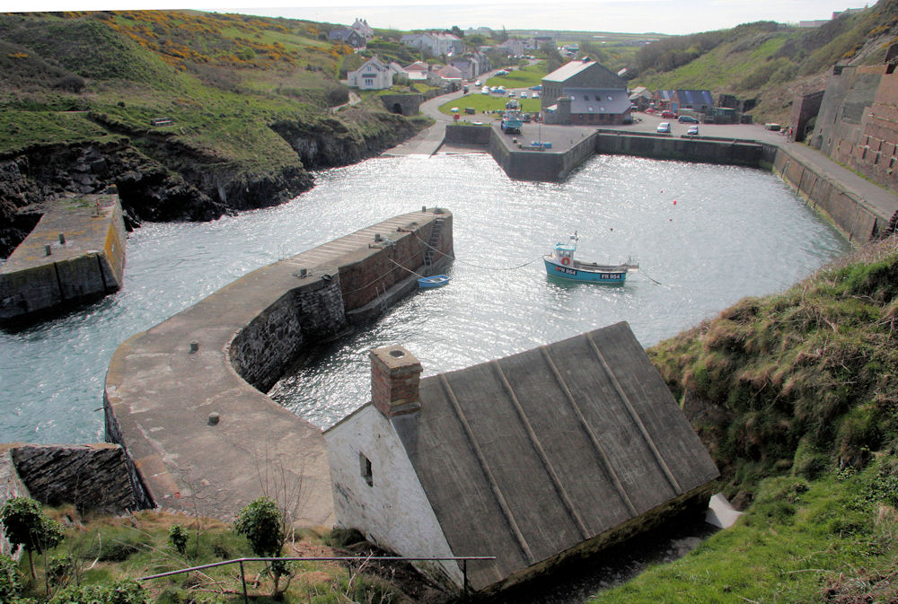
Porthgain is a Welsh word meaning "Chisel Port. The harbour was used for exporting road stone, slate and bricks and the old brickworks and stone bins still remain. The thirteen brick shipments out of here in 1931 were the last. The large slate roofed, stone building in the centre of the harbour is called Ty Mawr and is owned by the National Park.Although the harbour is now sparsely populated, during the 19th century it boasted a fleet of nearly 100 vessels, guided into its harbour by two distinct navigational markers, one a pyramid the other a cone.
Return to Area Map