
Image © David Medcalf (under Creative Commons licence)
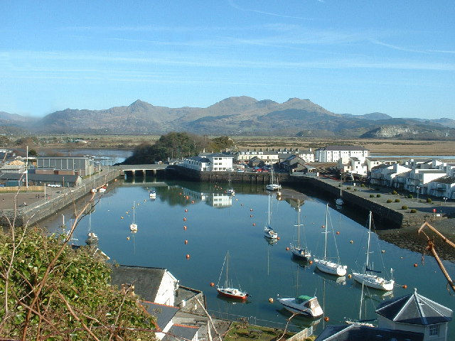
Porthmadog
Latitude: 52° 55'N
Longitude: 04° 07'W
Country: Wales
Ownership: Gwynedd Council
Type: Municipal
Usage: Leisure
Contact name: David O'Neill, Harbour Master
Address: Harbwr Porthmadog, Cei Greaves, Porthmadog, LL49 9LU
Telephone no: 01766 512927
About Porthmadog
Porthmadog is a busy town situated on the borders of Snowdonia and the Llyn Peninsula on the Glaslyn Estuary. Until 1974 this town was known as Portmadoc after William A Maddocks who built the Cob embankment in 1811. The present harbour was constructed in 1825.As a result of the expanding slate trade the town and the harbour grew steadily through the middle of the nineteenth century. The commercial future of Porthmadog as a harbour began to decline with the arrival of the Cambrian Railway in 1867. The last of Porthmadogs fleet of ships had disappeared by 1945 ending with it an important chapter in the history of the town.
Care should be taken when trying to make it into Porthmadog from the sea as sand bars in the estuary are constantly shifting and the marked channel has to be adjusted regularly. Seek advice from the harbourmaster before attempting to make it into the harbour, especially if you've not done it before. The tide is also a factor that has to be considered here.
Return to Area Map