
Image © Aubrey Dale
Coleraine
Latitude: 55° 07'N
Longitude: 06° 43'W
Country: N. Ireland
Ownership: Coleraine Harbour Commissioners
Type: Trust
Usage: Leisure, Commercial
Contact name: Capt. Pat McKeegan, Harbour Master
Address: Harbour Office, 4 Riversdale Road, Coleraine BT52 1XA
Telephone no: 028 7034 2012
E-mail: coleraineharbour@aol.com
About Coleraine
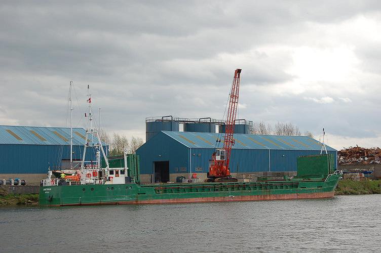
Coleraine Harbour, a small tidal port, is situated on the River Bann, 4½ miles from the entrance. The barmouth and channel to the harbour is maintained at 3½m below chart datum. A heavy swell may prohibit entry and exit.It is a small commercial harbour, which handled 75,000 tonnes of cargo in 2007. The port averages about 50 coasters per year; the largest cargo handled to date was 2,135 tonnes of recycled metal.
The principal export is recycled metal; imports include steel, timber products and general cargo.
The port has three quays totalling 217m in length and has three transit sheds totalling 2,610 sq.m. One 45 tonne crane and an 8 tonne Crawler crane are available for general and bulk cargoes. One 900 hp twin screw tug Confidence is available, with an 11t bollard pull.
The harbour offers facilities to leisure craft, including lift in / out up to 18 tonnes, undercover storage and outside hard standing. The harbour is close to two other marinas, Coleraine Marina and Seaton's Marina.
The port and pilot vessel work on VHF channel 12. Admiralty chart 2494. Imray chart C64.
Return to Area Map