
Image © Oliver Dixon (under Creative Commons licence)
Ballantrae
Latitude: 55° 05'N
Longitude: 04° 59'W
Country: Scotland
Ownership: South Ayrshire Council
Type: Municipal
Usage: Leisure, Fishing
Address: Macadam House, 34 Charlotte Street, Ayr, KA7 1EA
Telephone no: 01465 713648
Website: www.south-ayrshire.gov.uk...ntrae.aspx
About Ballantrae
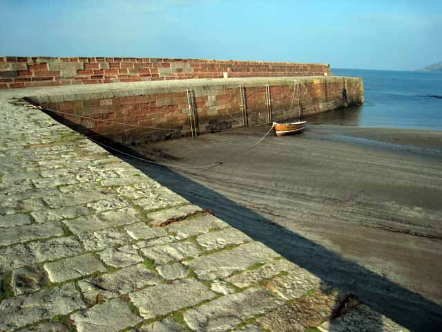
Ballantrae or "Kirkubright on Tig" as it was once known is situated some 12 miles to the south of Girvan on the coast road (A77). The harbour was developed further in 1847, at a cost of £6,000, to form the present structure.Ballantrae's small harbour sits at the mouth of the River Stinchar and has a stone flagged quay. The harbour used to be a calling point for the Stranraer/Glasgow Steamer and was once an important fishing village.
Ballantrae had a well-developed fishing community in the past with fishermen and their families at one time occupying all the cottages along the foreshore. As with most of these small fishing towns and villages there is no commercial fishing now based here, and all sailing is limited to leisure sailing.
Return to Area Map