
Image © John Maclennan
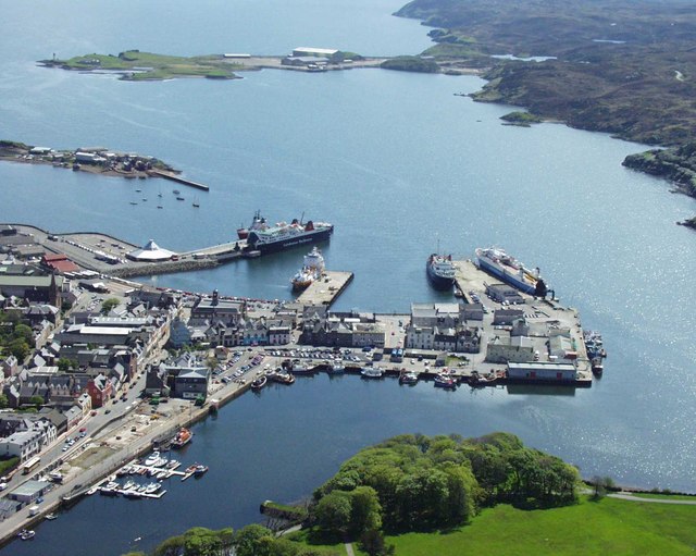
Stornoway
Latitude: 58° 11'N
Longitude: 06° 22'W
Country: Scotland
Ownership: Stornoway Port Authority
Type: Trust
Usage: Leisure, Fishing, Commercial, Ferry Terminal
Contact name: Captain Torquil Macleod, Harbourmaster
Address: Amity House, Esplanade Quay, Stornoway, Isle of Lewis, HS1 2XS
Telephone no: 01851 702688
E-mail: sypa@stornowayport.com
Website: www.stornoway-portauthority.com
About Stornoway
The harbour is capable of handling vessels up to 140m and 13,000 GRT alongside, with no size limit at anchorage. It has three main piers, one of which accommodates a busy Ro/Ro ferry, which serves the islands. There are also three quays for smaller vessels, such as the large fishing fleet based in Stornoway.Other docking facilities include Glumaig Quay at Arnish, purpose built for the oil industry and with significant room for expansion. It has a 100m length with an average depth of 6.5m.
Located at Goat Island is a slipway, which can accommodate vessels up to 800 tonnes displacement or 45m by 10m beam, with side slip facilities up to 400 and 200 tonnes displacement. There is also a new marina built in very sheltered water in the inner harbour area, which is used by the many pleasure craft that visit the Island every year.
All this coupled with modern facilities including bunkers, fresh water, fuel and oils, waste disposal and other important amenities, makes Stornoway harbour the ideal place for companies to base themselves, especially for the oil-related industries.
Stornoway harbour is at the heart of supply routes to the Atlantic Frontier, and is in an ideal positon for those intending to work on the the Atlantic. It has heavy and light engineering workshops, purpose-built offshore fabrication facilities, the potential to anchor semi-submersable veseels and development land close by. It is the crux of future Atlantic development.
Return to Area Map