
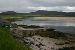
Keoldale East
Latitude: 58° 33'N
Longitude: 04° 47'W
Country: Scotland
Ownership: Highland Council
Type: Municipal
Usage: Ferry Terminal
Contact name: Mr John Whyte, Acting Harbour Master, Kinlochbervie
Telephone no: 01971 521235
Website: www.capewrath.org.uk/Kyle.htm
About Keoldale East
A passenger ferry operates across the Kyle of Durness, between the village of Keoldale on the eastern shore, and the end of the road from Cape Wrath on the western side.Return to Area Map