
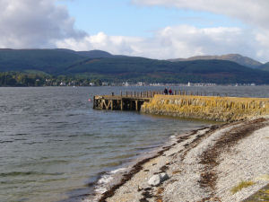
Strone
Latitude: 55° 59'N
Longitude: 04° 53'W
Country: Scotland
About Strone
Built in 1847 for the Clyde steamer trade, the pier was rebuilt in 1930. The shore end of the pier is made of stone, but the seaward end is of timber construction.It was owned by the Forestry Commission in 1951 but was closed in 1956. It is no longer used.
Return to Former Harbours Map