
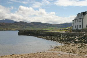
Portnancon
Latitude: 58° 30'N
Longitude: 04° 41'W
Country: Scotland
Type: Private
Usage: Leisure
About Portnancon
This quay is situated on the western bank of Loch Eriboll at the end of a minor road leading off the A838 road. It used to be the western terminus of the ferry service across the Loch, from Ard Neakie. The former Custom House is now a private guest house.Return to Area Map