
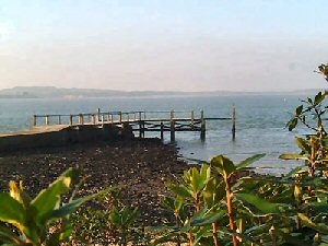
Pottery Pier
Latitude: 50° 41'N
Longitude: 01° 59'W
Country: England
Ownership: The National Trust
Type: Private
Usage: Leisure
About Pottery Pier
A horse-drawn railway from the pottery brought bricks, tiles and pipes to barges moored at the "New pier" constructed in 1855 to replace an earlier pier 200m to the south.Today it is used by visitors landing by dinghy from boats anchored in the popular anchorage to the east of Brownsea.
Return to Area Map