
Naast
Latitude: 57° 47'N
Longitude: 05° 39'W
Country: Scotland
About Naast
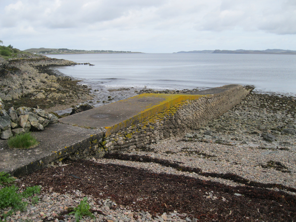
This jetty was built in WW2 for resupplying Russian Convoy ships. It appears to be constructed of sandbags, or bags of cement. It is no longer used.Return to Former Harbours Map