
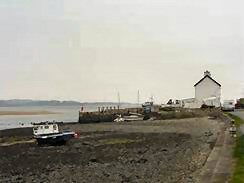
Tal-y-Foel
Latitude: 53° 09'N
Longitude: 04° 17'W
Country: Wales
Type: Private
Usage: Fishing
About Tal-y-Foel
The pier used to be an important ferry crossing point from Anglesey to Caernarfon, as early as the 15th century. It is now used by a few local fishermen.Return to Area Map