
Image © Aubrey Dale
Rostrevor
Latitude: 54° 06'N
Longitude: 06° 12'W
Country: N. Ireland
Type: Unknown
Usage: Fishing
About Rostrevor
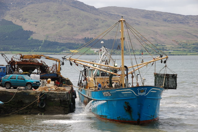
There are mussel beds in Carlingford Lough and mussel harvesting is undertaken on a significant scale. One of the boats involved is seen arriving at the small quay at Rostrevor, known locally as Rosses Quay.Read more about local mussel farming.
Return to Area Map