
Lamb Holm
Latitude: 58° 53'N
Longitude: 02° 54'W
Country: Scotland
About Lamb Holm
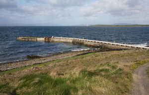
This pier is believed to have been constructed at the same time as the Churchill Barriers (1940-1943) and may have been used to bring in equipment etc. It may also relate to the prisoner-of-war camp that existed on the island during WW2.It does not appear to be in current usage.
Return to Former Harbours Map