
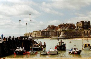
Broadstairs
Latitude: 51° 22'N
Longitude: 01° 27'E
Country: England
Ownership: Thanet District Council
Type: Municipal
Usage: Leisure, Fishing
Contact name: Harbour Office
Telephone no: 01843 861879
About Broadstairs
A small town situated at the extreme north-eastern corner of the Kent coast, Broadstairs and the sea go hand-in-hand. For hundreds of years the people of this area earned their living from some aspect of the sea - whether it was fishing, boat building or smuggling.Thanet was an island when the Romans invaded Britain. In time the fishing village of Bradstow (Anglo-Saxon meaning a broad place) grew to become Broadstairs.
Boat-building was first recorded as a most important growth in 1485, and by the 17th and 18th centuries was the biggest industry in Broadstairs.
In 1538 the first pier and the York gate were built in order to aid and protect the ship yard in Harbour Street. The town's people helped provision the English fleet anchored off-shore in 1588 while they awaited the Spanish Armada. Later many large vessels were built for the Royal Navy and for merchant firms, until exhaustion of the woodlands that covered the area led to the cessation of shipbuilding in 1824.
The arrival of the railways in 1863 brought more and more holiday-makers to the town, which grow quickly in the late part of the century. Although the harbour still supports a small number of commercial fishing boats, these days the majority of sea-going is for pleasure rather than profit.
Return to Area Map