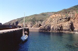
La Maseline (Sark)
Latitude: 49° 25'N
Longitude: 02° 19'W
Country: Channel Islands
Ownership: Isle of Sark Harbours Committee
Type: Private
Usage: Leisure, Ferry Terminal
Contact name: Mr J Carie, Harbour Master
Telephone no: 01481 832323
About La Maseline (Sark)
Sark is one of the largest of the Channel Islands, marked by steep cliffs and rugged natural scenery.Maseline is Sark's deep water harbour and used by the ferries from the other islands. Work started on it in 1938 and was interrupted by the German Occupation years. However it was finally opened in 1949.
Return to Area Map


