Reiff
Latitude: 58° 04'N
Longitude: 05° 27'W
Country: Scotland
Type: Unknown
Usage: Fishing
About Reiff
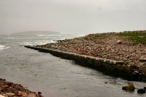
This very exposed jetty is almost covered at high tide, or when the wind is onshore. It is no longer used except by the occasional small fishing vessel. It is situated at the very end of the road to the Coigach peninsula.Return to Area Map


